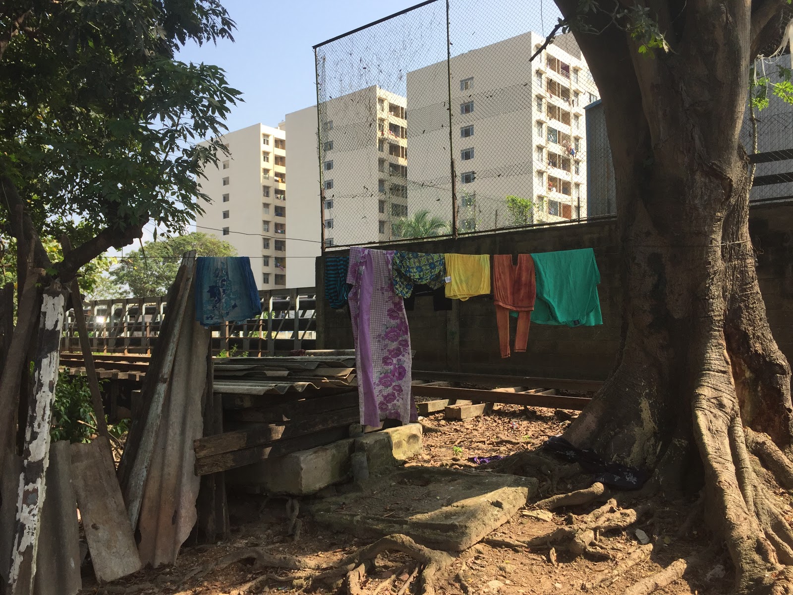
The Unknown City: the (in)visibility of urban displacementBackgroundAs part of the completed urban study, data was collected to understand the lifestyles, experiences and aspirations of people in four underserved communities in the Colombo city, which were Lunupokuna, Samantharanapura, Kirulapona and Wadulla, situated in the Colombo, Thimbirigasyaya and Kolonnawa DSDs. During a period of 2 years researchers used techniques such as oral histories, walks, photos, migration videos, community profiles, social, historical, resource and infrastructure mapping, and graphical accounts at individual, community and city level. The approach included application of software’s like Ushahidi, Ramblr etc. and collaborations with art and comics specialists to develop stories and drawing works. Below are more details on the methods and some of the outputs. 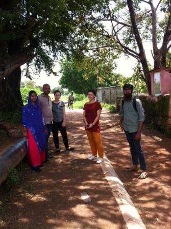
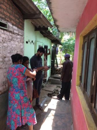
Researchers with colleagues in the field PhotographyPhotos give useful insights into the day to day life of the people and the community. 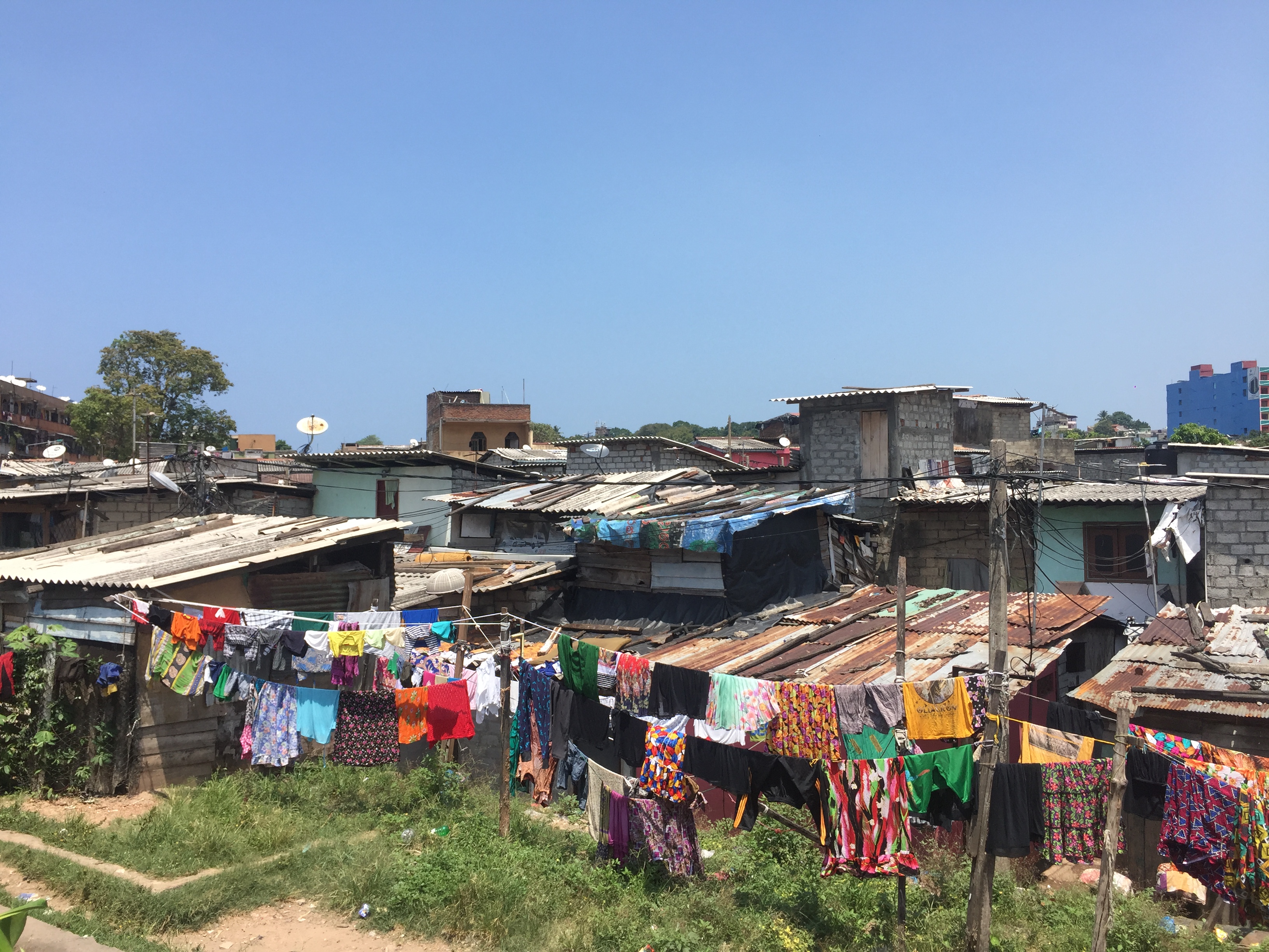

Ramblr walksRamblr allowed us to trace the daily and weekly routines of people with geo located photos, videos and voice recordings. It gave a unique insight into their world and what is important to them. 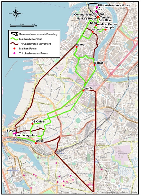

Ramblr maps of routines Mobility videosVideos of hand drawings were used to create distinctive illustration type life-stories of mobility. People were allowed to reflect on their spatial history and narrate their journey as they drew their movements, which were then filmed and edited with subtitles. 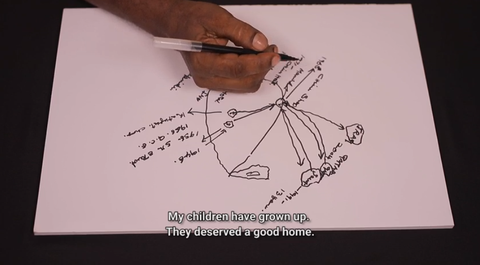
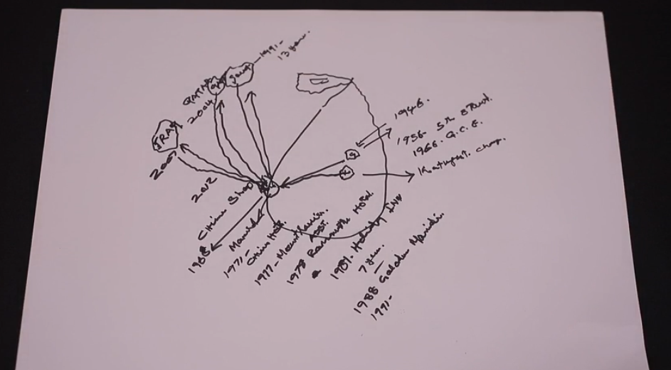
Mobility video drawings Movement mapsOral histories and timelines were specially useful for creating movement maps that showed the sheer number of places migrants had called home, and sensed various levels of belonging, before settling at the current place. 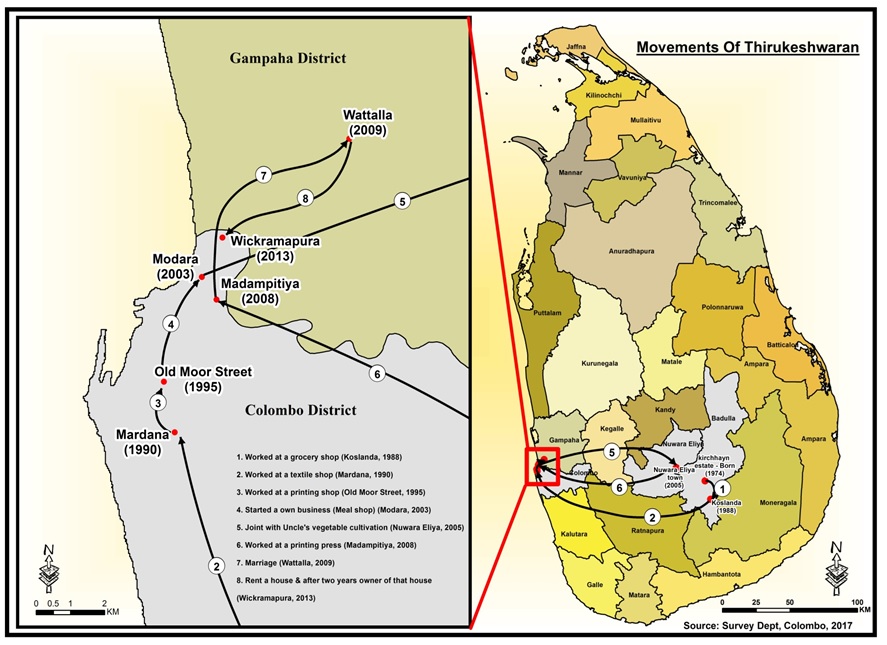
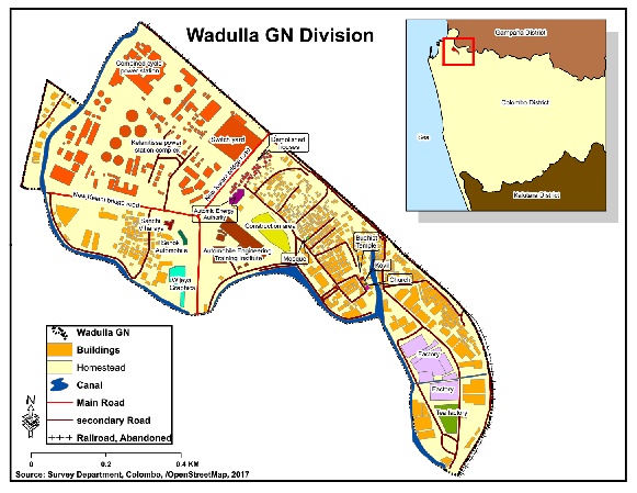
Movement map Resource mapsOne of the techniques we used is mapping the resources in each of the sites. This helps understand individual and community behaviour and their relationship with the built environment. 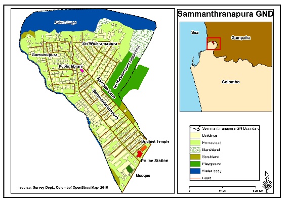
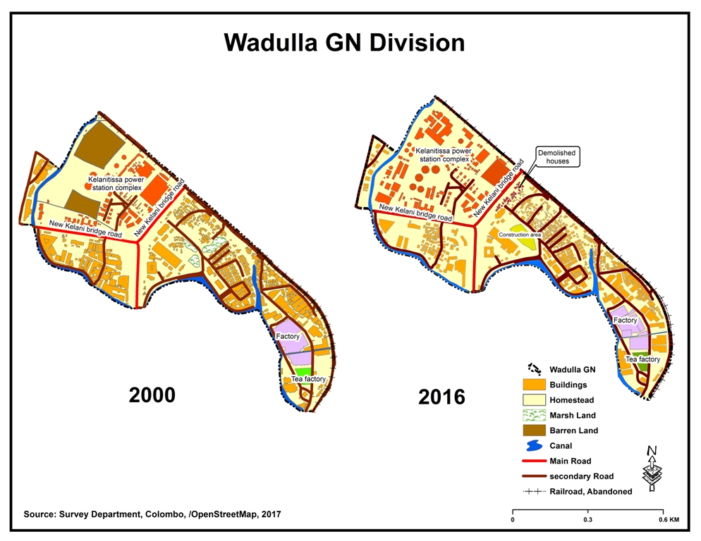
Resource maps of two sites Comparison mapsThese help to understand how the area had developed. For example the below maps illustrates the expansion of the settlement, reshaping landscape and destruction of natural settings and how that may have contributed to the frequent floods. 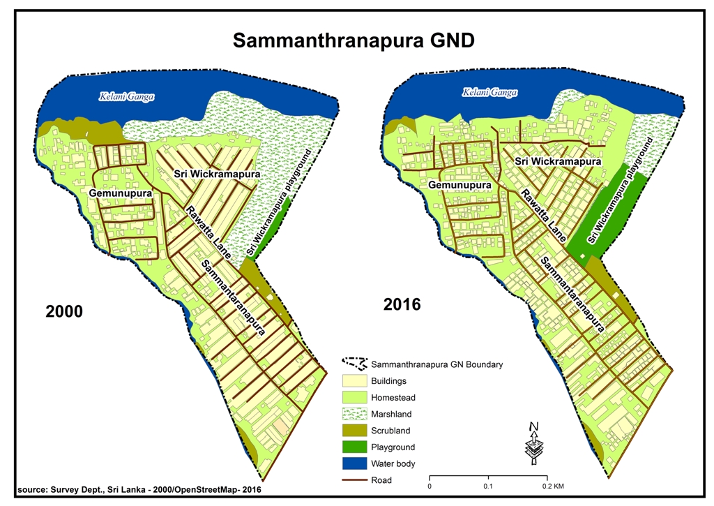
Comparison maps of two sites Historical maps, archive and city plansSuch can help understand how the city as a whole had evolved over time. By tracing and connecting them with individual and specific community perspectives and mobility histories, it can give a picture of how migration and informal housing have played and continue to play an importnat role in the life of the city, and how successive planning efforts have responded. 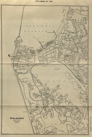
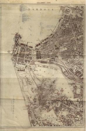
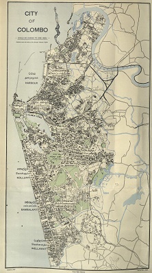
Maps of Colombo as the city evolved Sources: Brohier, R. L and Paulusz, J. H. O. (1951) Land, Maps & Surveys: Descriptive catalogue of historical maps in the surveyor general’s office, Colombo, Vol. II Ceylon Government press, Colombo (maps 1 and 2); Hulugalle, H.A.J. (1965) Centenary Volume of the Colombo Municipal Council 1865 – 1965, Colombo Municipal Council (map 3). 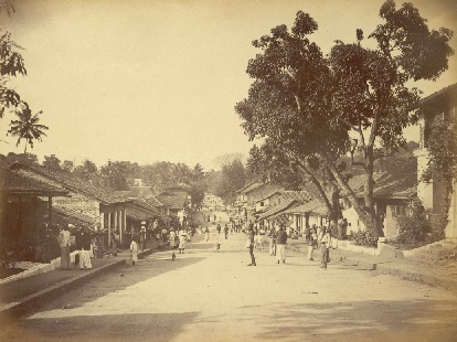
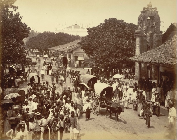
Colombo and Pettah streets scenes in 1880 Source: Nineteenth Century Collections Online, Photo 1 and Photo 2, Accessed 8 Nov. 2017. Art and comics workThe conceptual art work captured the artists imagination of life in the city. Accordingly ‘people living in underserved areas often migrate into the city from rural areas in the hope of a better life, but find themselves stuck at the bottom of a very complicated social and economic maze. With limited access to wealth and education, they have very little hope of making their way through to the higher echelons of society’. ‘Migrants on the Margins’ story book tells in comic method the real story of Arunachalam who migrated from the plantation sector to Wadulla in Colombo. The aim of the story is to increase the visibility of urban migrants while emphasising their unique life-journey experience. For more information see link. 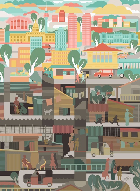

Art work and story book DisseminationA number of workshops were conducted in Colombo and abroad to disseminate the findings and share the research. See ‘Trapped Populations’ for more information on the joint dissemination and next steps. |


